Cristinas Project
Chihuahua Mexico
Cristinas Project By The Numbers
12
7 km
684
Hectares
2 Hour
20 km
Premier North American Copper Exploration
Cristinas
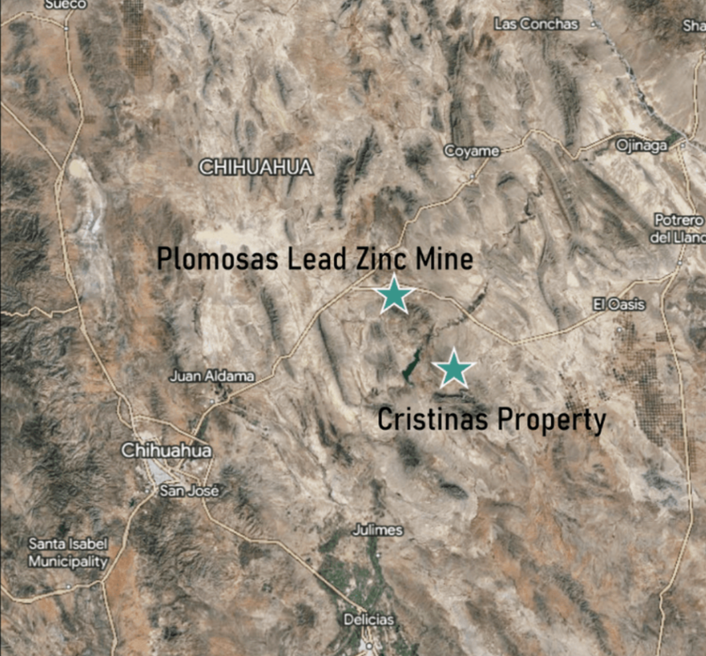
The 685-hectare Cristinas Project is in northeastern Chihuahua state, Mexico, approximately 2 hours by car from Chihuahua City. The Cristinas Project includes a historic copper mine that operated in the 1950’s on shallow copper oxide mineralization.
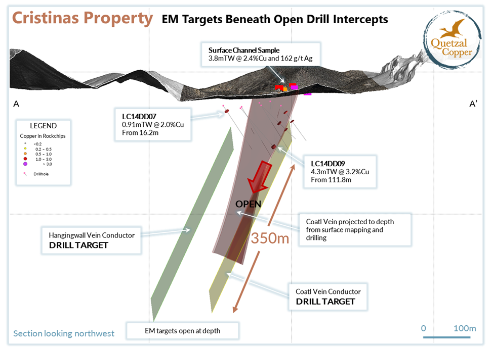
The project features a 1,250 m copper anomaly traced through rock chips on surface and 12 historical (2014) drill holes. Copper mineralization is open along strike and at depth with significant expansion potential highlighted by limited geophysical surveys. Drilling identified closely spaced, parallel structures with widths between 0.25 m to 10 m, including intercepts of 4.3 metres true width grading 3.2% copper and 3.7 meters (true width) of 3.0% copper. The deepest holes penetrated only 80 m below the surface.
Quetzal is preparing a drill program at the Cristinas project to evaluate these compelling targets. The company is planning a 1,500-3,000 metre initial drill program which will include downhole EM surveying to refine geophysical targets. Quetzal Copper will provide additional details as preparation advances.
Historic Work
Cyprium Mining drilled twelve holes in 2014. The two deepest holes hit the highest grades and widest widths:
LC-9: 10.57 m at 1.4% copper including 4.3 m at 3.2% copper
LC-10: 10.32 m at 1.4% copper including 2.5 m at 3.0% copper.
2024 Surface rock chip sampling returned 3.8 m of 2.4% copper and 162 g/t silver.
Working Hypothesis
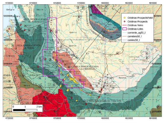
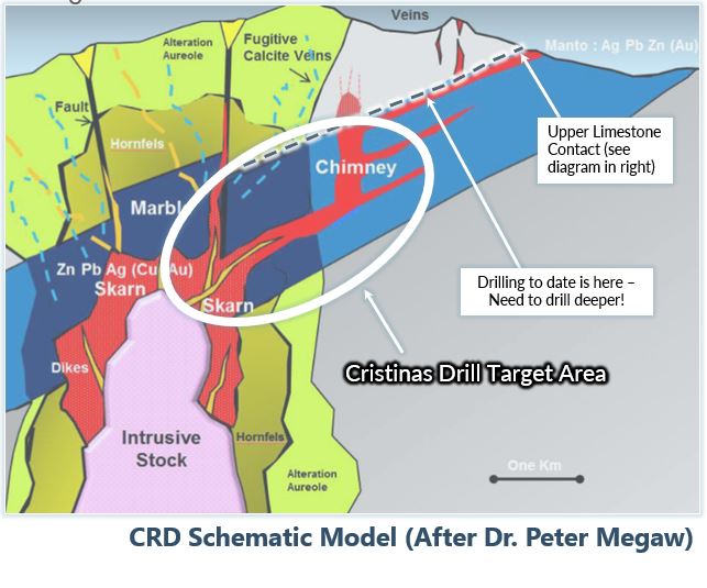
Our interpretation is that the Cristinas property is a distal carbonate replacement deposit (CRD). It may be related to an intrusion located about 1 km to the south. The known copper mineralization occurs over an area of about 1,500 m by up to 450 m in width. Unlike most CRDs, this one has a strong obvious structural control in the form of a fault that is slightly oblique to the bedding of the host limestone sediments.
The exposed portion of the system includes a broad area of thin veinlets, possibly splays related to the upper levels of a fault-vein system. These may coalesce into a main vein on the principal fault, or a chimney, as shown in the schematic. This is supported by the deepest drill hole, which hit the widest vein intersection and some of the best grades.
The Casitas Formation, composed of shales and sandstones, hosts the mineralized zone at Cristinas. The mineralization around the historic mine consists of multiple sub-parallel thin veins of calcite-iron oxide and variable amounts of copper oxides. Most of the veins are thin (10 cm to 30 cm), while two main veins reached widths up to 3 m thick. Disseminated pyrite in the surrounding rocks may be related to the mineralizing event and outline a footprint even larger than that outlined by copper mineralization at surface.
Exploration History
The Cristinas property hosts numerous small, old mines from an unknown time period. They are currently abandoned.
The mine produced oxide copper in the 1970’s and 1980’s. It was shut down until Cyprium completed a 12 hole drill program in 2014.

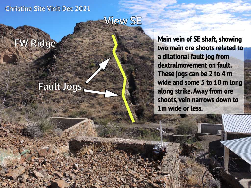
Historical work describes the mineralization at Cristinas as either hydrothermal or epithermal in nature.
A major fault at a slight angle to bedding controlled mineralization (vein emplacement). Fault jogs create wide spots (2 m to 3 m) along strike lengths of 5 m to 10 m. Between these areas, the veins pinch to less than one meter in width.
The fault jogs occur at approximately 50 m intervals along strike. The Cristinas 1 shaft sits adjacent to one of the jogs.
Cyprium’s 2014 drill program highlighted some attractive qualities for Cristinas. Primarily, that the system carries grade. The program intersected copper mineralization up to 6.4% copper. And that the system remains open at depth.
The two deepest holes from the 2014 drill program intersected the highest grades and widest widths:
- LC-09: 10.6 m (true width) at 1.4% copper; including 4.3 m (true width) at 3.2% copper
- LC-10: 10.32 m (true width) at 1.4% copper; including 2.5 m (true width) at 3.0% copper
The historic exploration program focused on a 550 m long by 200 m wide area. Quetzal’s team will expand that area to the northwest and southeast.
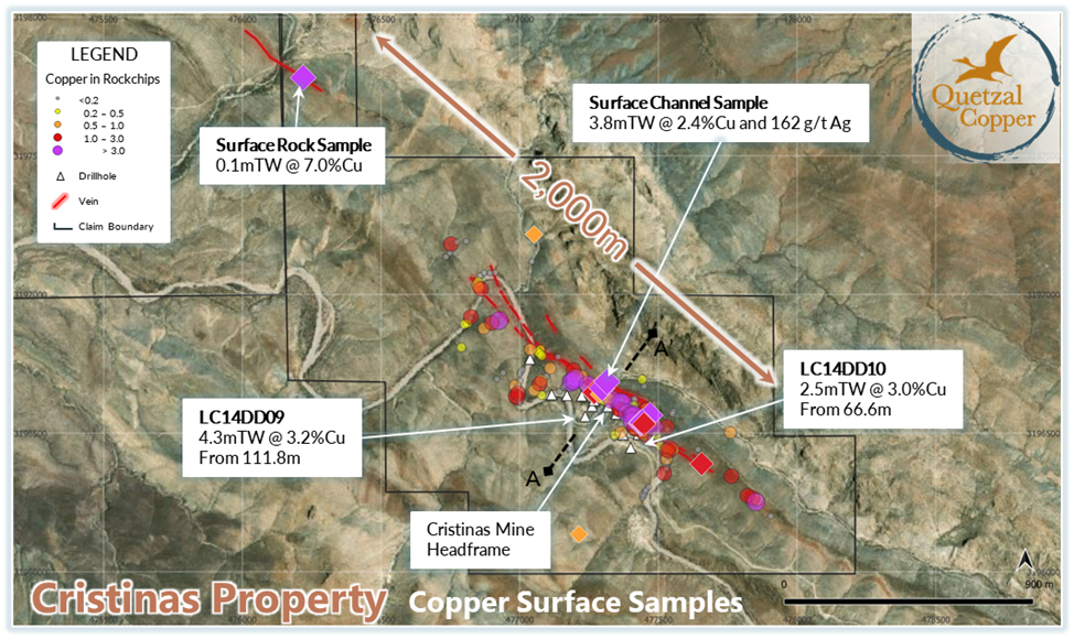
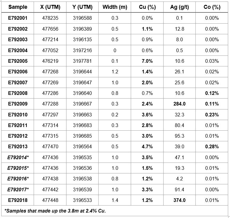
As part of the due diligence of the Cristinas project, the Company collected 18 rock chip samples across prospective target areas around the historic Cristinas Mine. The mine operated at a small scale down to 50m below surface in the 1950’s.
The due diligence surface rock sampling results of 18 samples returned values ranging from <0.1 to 7.0% copper, mainly in copper oxides. Only four of the eighteen samples returned less than 1.0% copper. The highest grade of 7.0% copper came from a narrow vein located 1,550 m northwest of the historic Cristinas mine workings.
The team only found one vein with enough exposure to collect multiple samples across its width. It was in the historical mine area. The sampling resulted in a 3.8 m true width grading 2.42% Cu with 162 g/t Ag and 0.005% Cobalt. Table 1 contains the complete results of the sampling program.
Another notable aspect of the sampling program are areas of significant cobalt grades. The cobalt appears to correlate with the high copper grades in some areas. It has the potential, with silver, to contribute to the economic value of mineralization at Cristinas.
