DOT Project
British Columbia
DOT Project
By the Numbers
25 km
7%
5
20 km
12 km

Advanced North American Copper Exploration
The DOT Project
The 846-hectare Dot project sits in the southern portion of the Guichon Creek batholith. It’s located just twenty-five kilometers northwest of Merritt, British Columbia. The property is road accessible, with excellent accessibility.
The project is just 20 km southeast of the Highland Valley mine and 11 km from the Craigmont mine. The project has all-season road access. The region hosted copper exploration for more than 130 years.
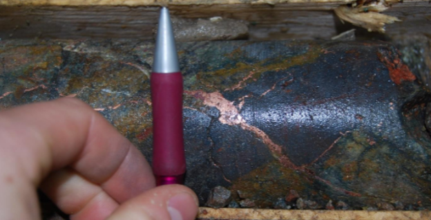
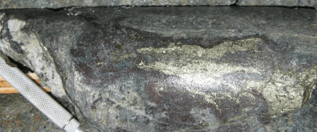
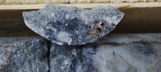
The DOT Project covers five significant and undeveloped zones of copper-silver-molybdenum-gold mineralization. Northwest, Southeast, East, West, and Copper zones. Wide, strongly altered mineralized zones dip steeply northwest. Disseminated copper sulphide and oxide mineralization occurs in fractures and veins. Elevated copper/silver/molybdenum/gold grades correlate with fracture density and intensity of phyllic alteration.
In 2008, Aurora Geosciences calculated a non-compliant indicated resource of 5.3 million tonnes at 0.49% copper equivalent and 2.9 million tonnes of non-compliant indicated resource 0.45% copper equivalent.
In 2010, the previous operator commissioned a resource report on the known mineralization.
Within the resource are large widths of higher grades:
- 81-13: 30.2m @ 1.32% Cu
- 81-18: 27.4m @ 2.58% Cu
- 92RCD-03: 76.2m @ 0.91% Cu
These grades and thicknesses indicate a robust copper system on the property.

Where is the Porphyry That is Driving the Mineralization?

The DOT project holds five mineralized zones, as you can see in the figure.
All five zones remain open. The mineralization indicates a porphyry system. Data collected so far show that the mineralized zones are small and isolated. But that’s likely just a lack of information. Dot needs a systematic program targeted at the “plumbing” of these zones.
Quetzal’s team will focus on the source of the mineralization. That will include geophysics and drilling to follow up and expand on the work done previously.
One area of interest is the East Zone. There are only two holes drilled in this zone. It appears to be a high-grade, narrow zone, striking 225°and with an unknown dip. This zone is open in all directions as it lies in an underexplored area of the property.
Historic drilling of the Southeast identified the lateral extent of mineralization. However, Hole 96-16 Southeast Zone ended in good mineralization, which needs additional drilling
The Copper Zone is still open at depth and up-dip. Additional drilling in this area will determine the limits of the mineralization.
More Induced Polarization surveying still needs to be completed in the area of the West Zone, and in the space between the Southeast and West Zones. Several undrilled IP anomalies offer new targets, as well as additional infill drilling between the West and Southeast Zones to follow up on holes DOT-09-W01 and W02.
A large portion of the property remains to be tested by Induced Polarity (IP) geophysics. Historically, only IP accurately differentiate between barren country rock and zones containing weakly disseminated sulphide minerals. Those zones host copper, silver, gold and molybdenum mineralization. IP is the best tool to detect mineralization in the under-explored regions of the property, as well as at greater depth.
Work Plan
- A comprehensive IP survey across the property
- Drill program at the East Zone
- Drill program at the Northwest Zone to potentially increase resource estimate
- Trench and drill the north portion of the Southeast Zone to extend high-grade
- Follow up Hole 96-16, which ended in open mineralization
- Preliminary metallurgical testing